/vis/a000000/a004600/a004695/NINO3.4SST_FlatMapComposite_1920x1080_p30.mp4 type=video/mp4>
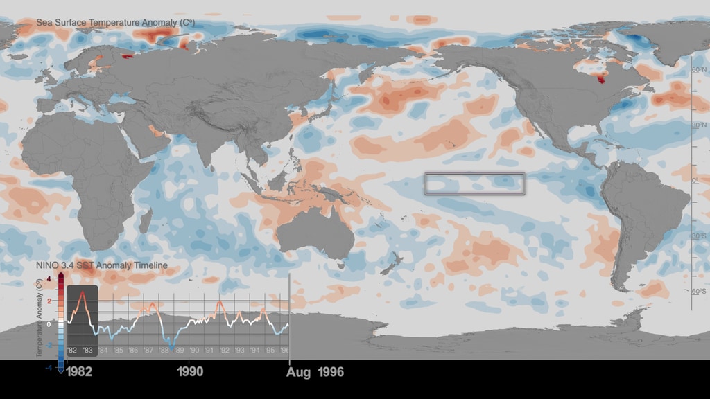
This visualization captures Sea Surface Temperature (SST) anomalies around the world from 1982 to 2017, along with a corresponding timeplot graph focusing on the Niño 3.4 SST Index region (5N-5S, 120W-170W), which represents average equatorial sea surface temperatures in the Pacific Ocean from about the International Date Line to the coast of South America. Highlighted in the timeline are the El Niño years, in which sea surface temperature anomalies peaked: 1982-1983, 1997-1998, and 2015-2016.